

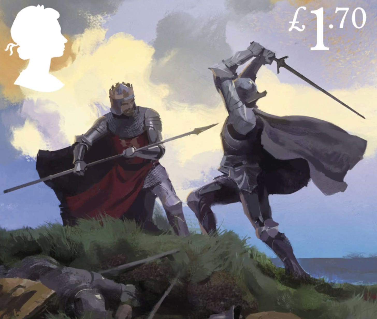
The Welsh annals record that Arthur and Modred died in a battle in 537 at a place called Camlann. Geoffrey of Monmouth identified the site with Camblan, a river in Cornwall now known as the Camel. Modred became Arthur’s enemy at Camblan and the final battle between Arthur and Modred served as the grand finale of Geoffrey’s retelling of the story of Arthur.
But Camlann is not Camblan. The river name is only similar. And in the 1930s it was proposed instead that the battle must have occurred at a site on Hadrian’s Wall in Cumberland. It had only just been realised a few years earlier that one of the Roman forts in Cumberland had been known in Latin as Camboglanna. The name was only recorded accurately on a decorated cup found in the eighteenth century at Rudge in Wiltshire. The Rudge cup is conserved in Alnmouth Castle in Northumberland and you can clearly see the names of several forts on Hadrian’s Wall written about its rim, including one spelled as Camboglans ‘from Camboglanna’.
Since then, two objects of a similar sort have been discovered: at Amiens in France and Ilam in Staffordshire. The find from Amiens spells the name of the fort as Cambog(lanna) and that from Ilam spells it as Cammogianna. Archaeologists have argued over whether the three finds were all cups or not – the objects may have been skillets or pans whose handles have broken off. But they seem to have been presented to Roman soldiers (or bought by them) who served at the western end of Hadrian’s Wall and they have the names of the local forts written on them.
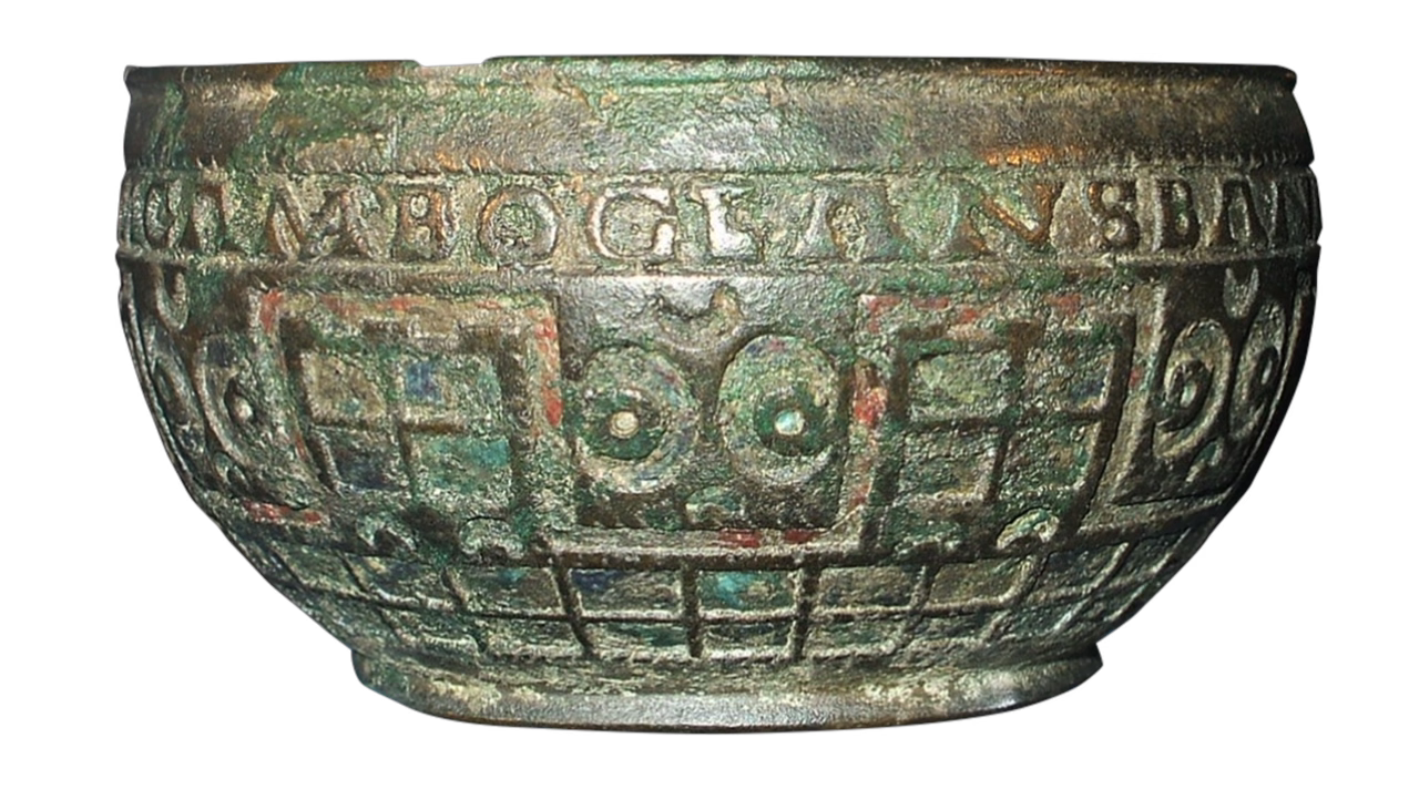
Previously Camboglanna was only known through ancient documents with the name corrupted slightly – as Amboglanna. But linguists can now analyse the name Camboglanna quite readily. The name of the fort literally means ‘crooked bank’ in Celtic – and Camlann is the expected descendant of Camboglanna in Old Welsh.
But how do we know that Camlann was Camboglanna in Cumberland? There are two places in Wales that are called Camlan today. They are both located in fairly obscure valleys, but in the 1970s, the owner of one of the farms in the area of Camlan in Gwynedd tried to cash in on the connection with Arthur. He erected a memorial to Arthur, with a plaque written in Welsh on it, and ran old stream trains for tourists to come up to visit his property.
The main problem with connecting either of the two Welsh places called Camlan with the site of Arthur’s final battle is linguistic. A similarly named place, Rhuddlan in Wales, is recorded as the site of a battle in 796 in the Welsh annals. The Welsh fought the Mercians there, but the name of the place is recorded in the Welsh annals as Rudglann ‘red bank’. It’s obvious from the spelling Rudglann that any place later called Camlan in Welsh must have been known as Camglann in the sixth century.
But the Roman fort of Camboglanna is not in Wales, it is in Cumberland, and the local language was not Welsh. The Celtic dialect formerly spoken in Cumberland is often called Cumbric, but it might be more accurate to just call it North Brittonic. It’s likely to have been similar to Welsh, but to have developed in a different manner. One of the ways in which Cumbric seems to be different than Welsh is that names like Camboglanna lost their g much earlier in North Brittonic.
North Brittonic is difficult to get a grip on linguistically as no texts written in Cumbric have survived. Quite a lot of North Brittonic names are recorded, however, and they demonstrate that the northern Celtic dialects of Britain developed differently than Welsh. It’s just what you’d expect given how dialects usually behave. Sometimes sound changes occur in some dialects and not others, but they can also just occur earlier in some dialects than in others.
The best evidence for North Brittonic is preserved in place-names, and there is a river in Northumberland whose name is comparable to Camboglanna. It’s called the Devil’s Water today, but it was known in the thirteenth century as the River Diveles. Place-name specialists agree that Diveles meant ‘black stream’ in North Brittonic and that its ancient name must have been Duboglassia. After all, there are many rivers in Britain whose names have the same etymology. The river name often appears as Douglas in modern English, but rivers with the same etymology are also attested as Dawlish, Dowlish, Divelish, Dalch and Dowles today.
The name of the Diveles must have passed into English when the area in Northumberland that the river flows through became part of the Anglo-Saxon kingdom of Bernicia – probably in the sixth century. The Devil’s Water flows into the Tyne just south of the Roman fort at Corbridge, not far from Hexham. But unlike the rivers called Douglas, the g has not survived in Diveles. The g seems to have already been lost from the Brittonic dialect spoken in the region about Hadrian’s Wall in the sixth century.
The linguistic evidence isn’t categorical, but it points to Camboglanna in Cumberland being the site of Arthur’s last battle, not somewhere in Cornwall or Wales. But which fort on Hadrian’s Wall is Camboglanna?
For a long time, it was thought to be Birdoswald, a site you can visit today as it is managed by English Heritage. But in the 1970s it was noted that the river at Castlesteads is called the Cam Beck and that Castlesteads is a more likely candidate for Camboglanna. The problem, however, is that the site is still privately owned and that there is very little to see there. The fort has long since been demolished.
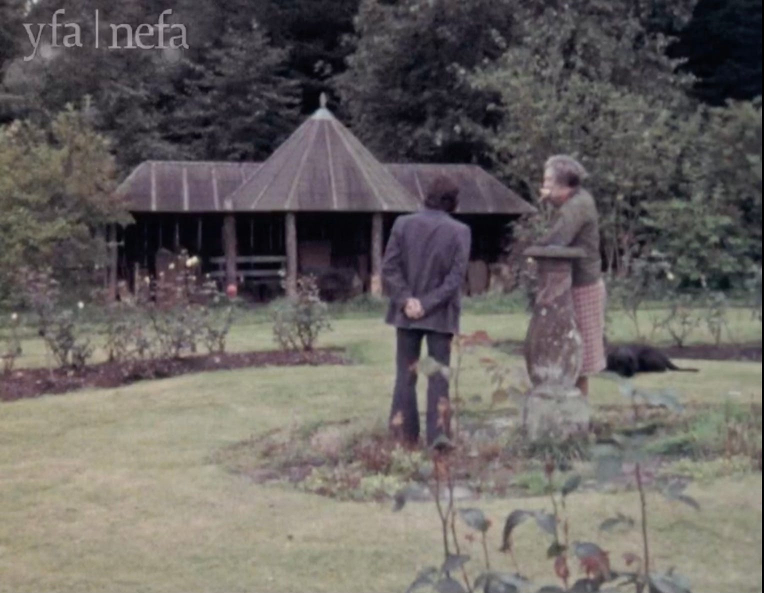
No one seems to have quite cottoned on about Castlesteads yet. Because Camboglanna was only recognised to be at Castlesteads in the 1970s, the site has never been treated very seriously by archaeologists. It was excavated in the 1930s before the connection with Camlann had been made and a magnetic survey of the area published in 2007 showed that a civilian settlement clustered around the south of the fort in Roman times. The doubts over whether Arthur was historical that re-emerged in the 1970s haven’t helped either. But Castlesteads is one of the worst preserved sites on Hadrian’s Wall – the fort has partly fallen into the Cam Beck, and in the eighteenth century the site was turned into a garden by its owners, the Johnson family.
Asked in 1974 why the Johnsons hadn’t made any attempt to open the site up to the public, Lady Johnson replied “we don’t think it’s interesting enough”. The inscribed stones excavated from the fort in the 1930s were heaped together in an old summer house when The Living Wall documentary was made that year. “We don’t treat the Roman remains with the reverence we should” Lady Johnson acknowledged. When asked whether the stones should be in a museum, she replied “I don’t think these are really good enough.”
The inscriptions from Castlesteads have all been published. The Johnsons allowed access to them in the 1940s when the first volume of the Roman Inscriptions of Britain was being put together. But one of the inscribed stones from Castlesteads catalogued at the time is from the sub-Roman period. It clearly dates to the fifth or sixth century and it may be contemporary with Arthur.
Such a shame the site in Castlesteads has been so neglected. Any archeologist out there?